top of page
CRANBERRY MARSH ESTATES • COLLINGWOOD • LIMITED RELEASE •
THE SETTING
A curated collection of aerial views highlighting the site, surrounding landscape, and broader Cranberry community.
Context & Lifestyle
01
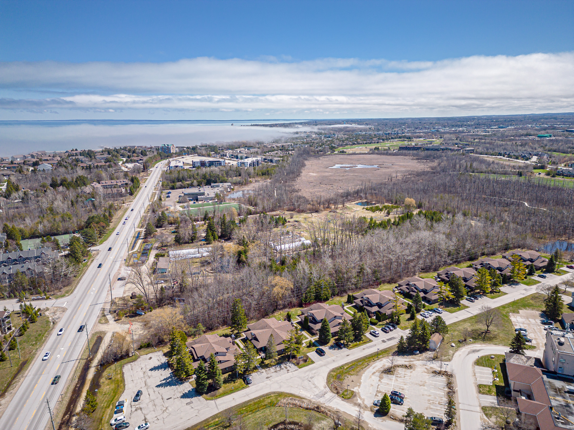
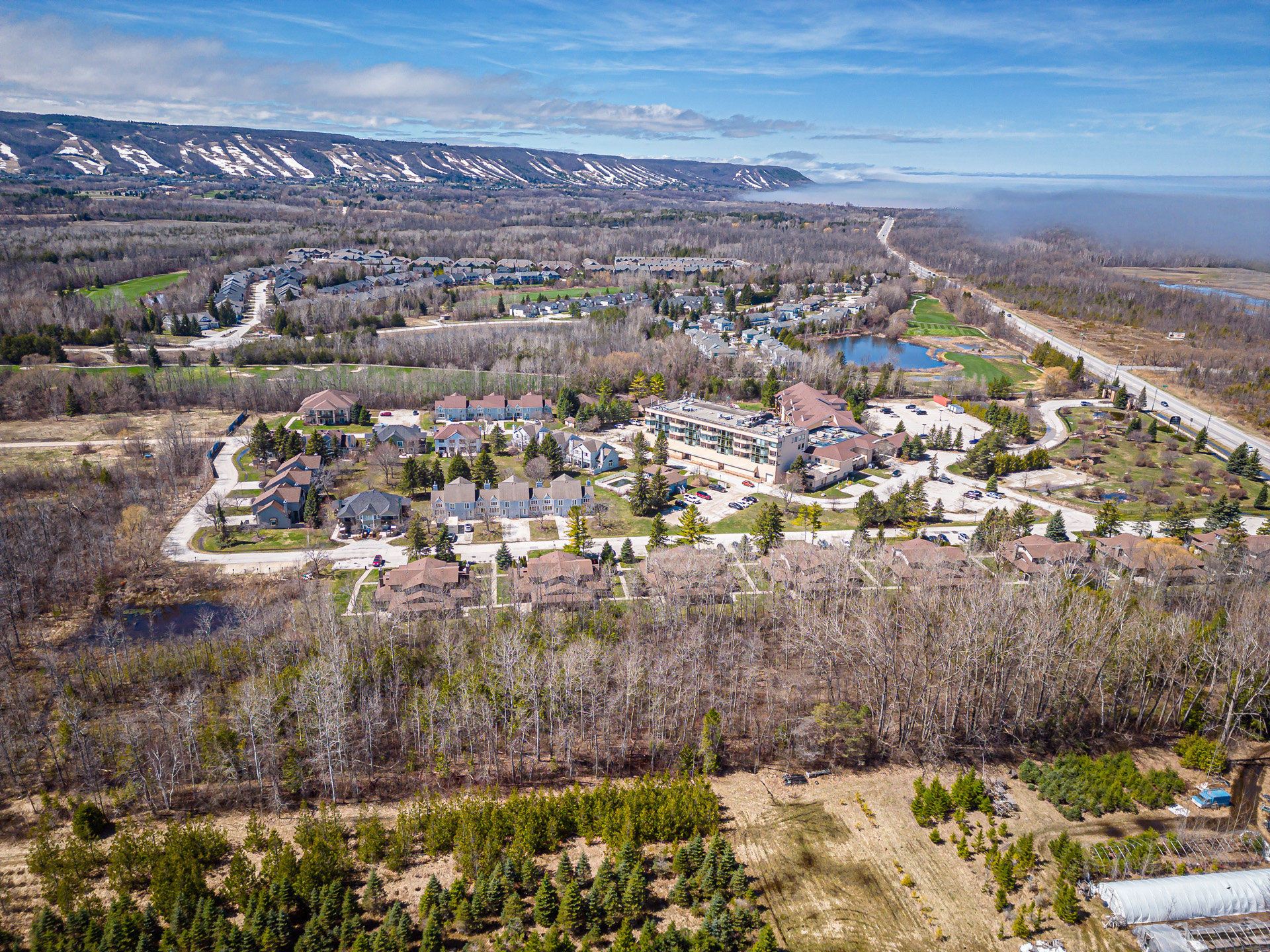
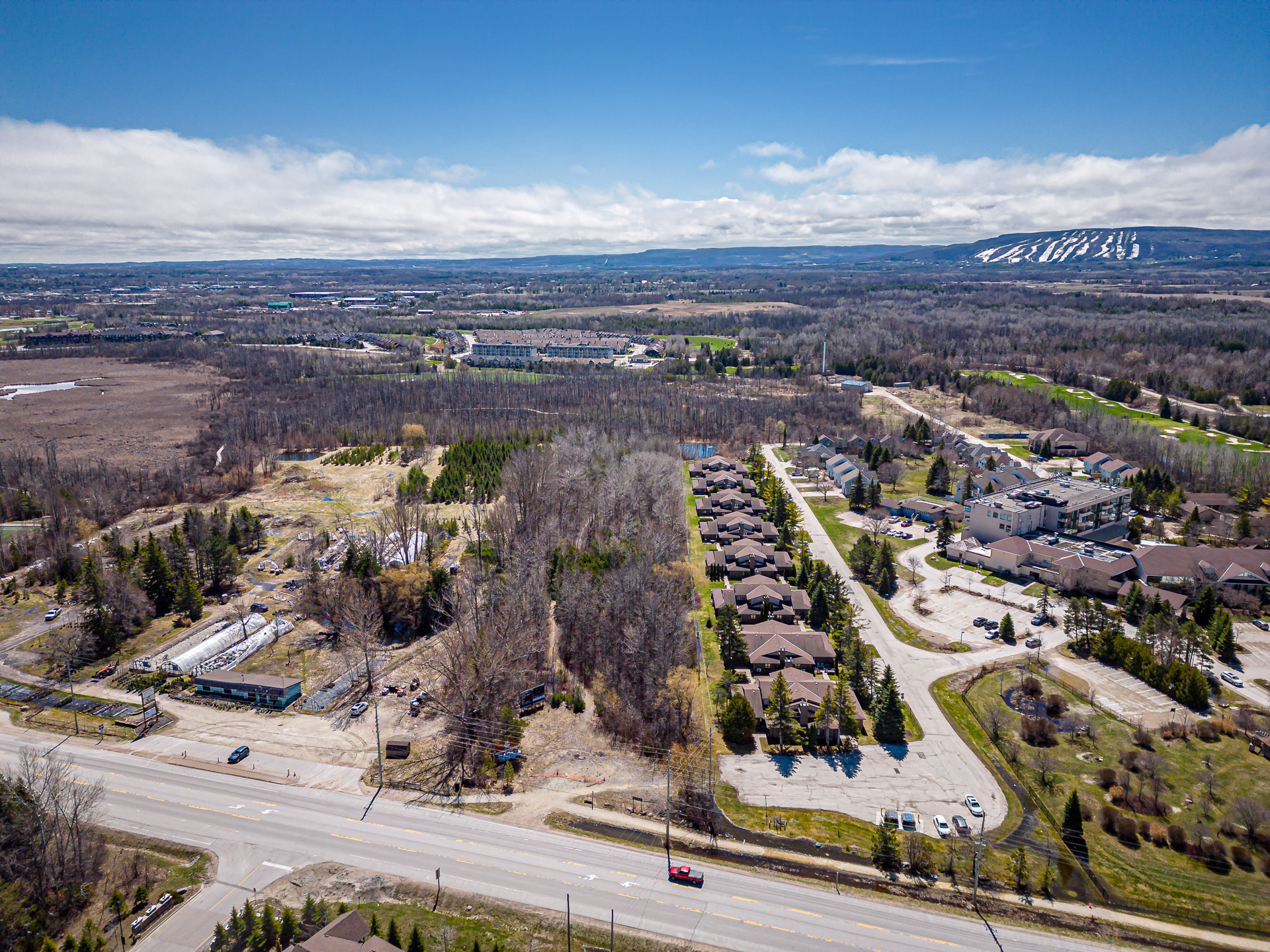
Cranberry Corridor
Positioned along Highway 26 with views stretching toward Georgian Bay.

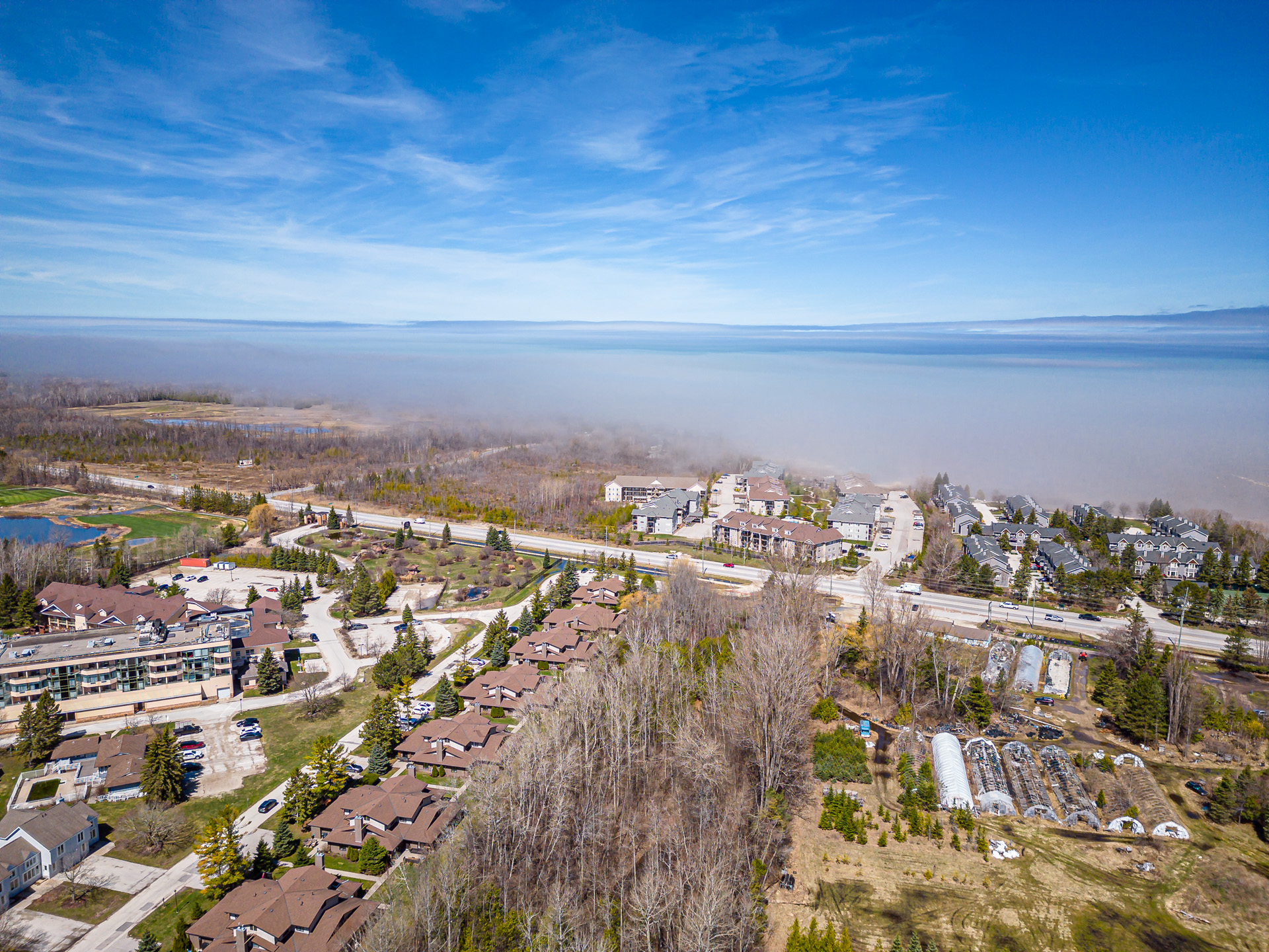
02
Bay Proximity
Just minutes from the shoreline, with easy access to waterfront trails and open space.

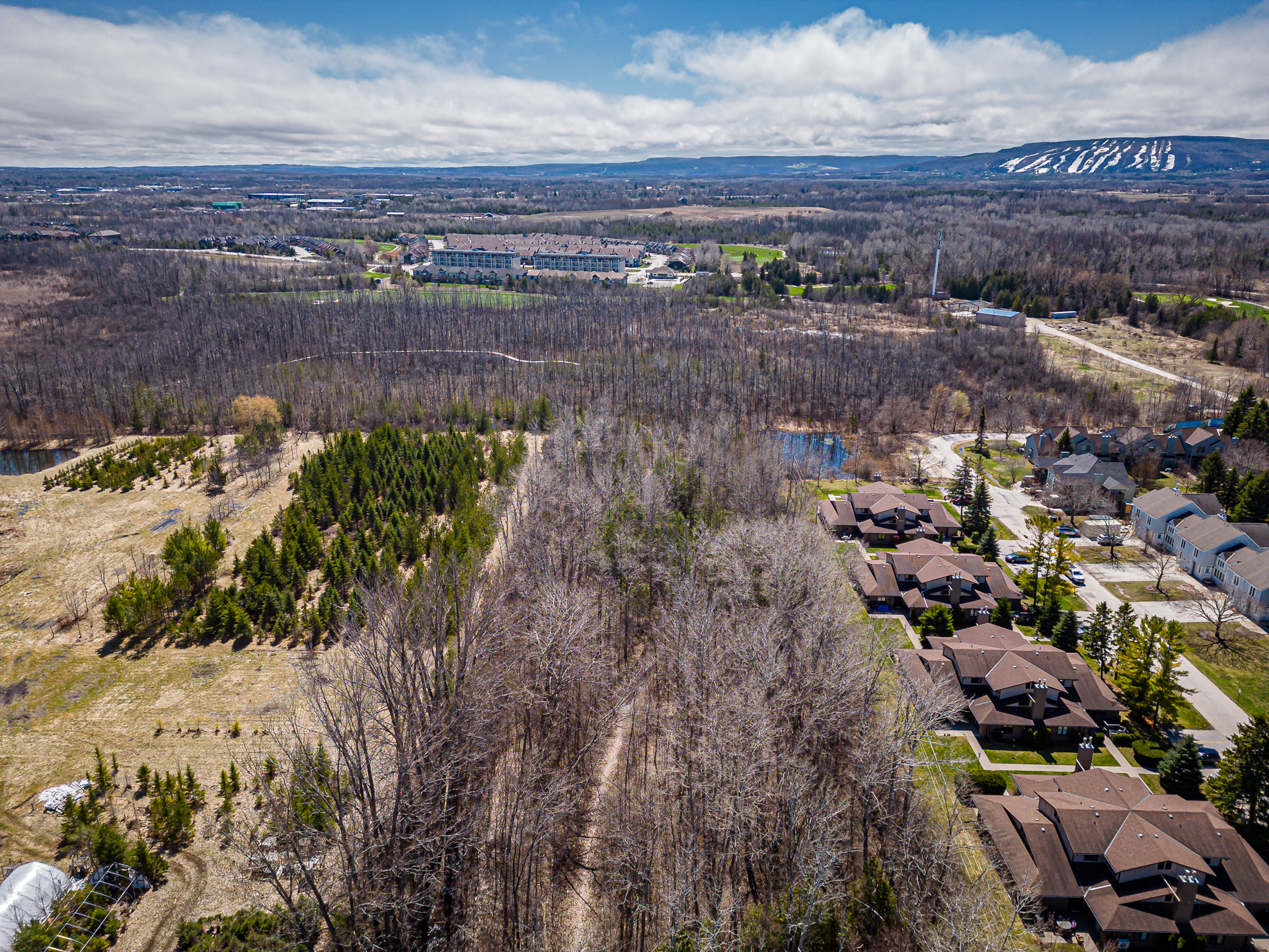
03
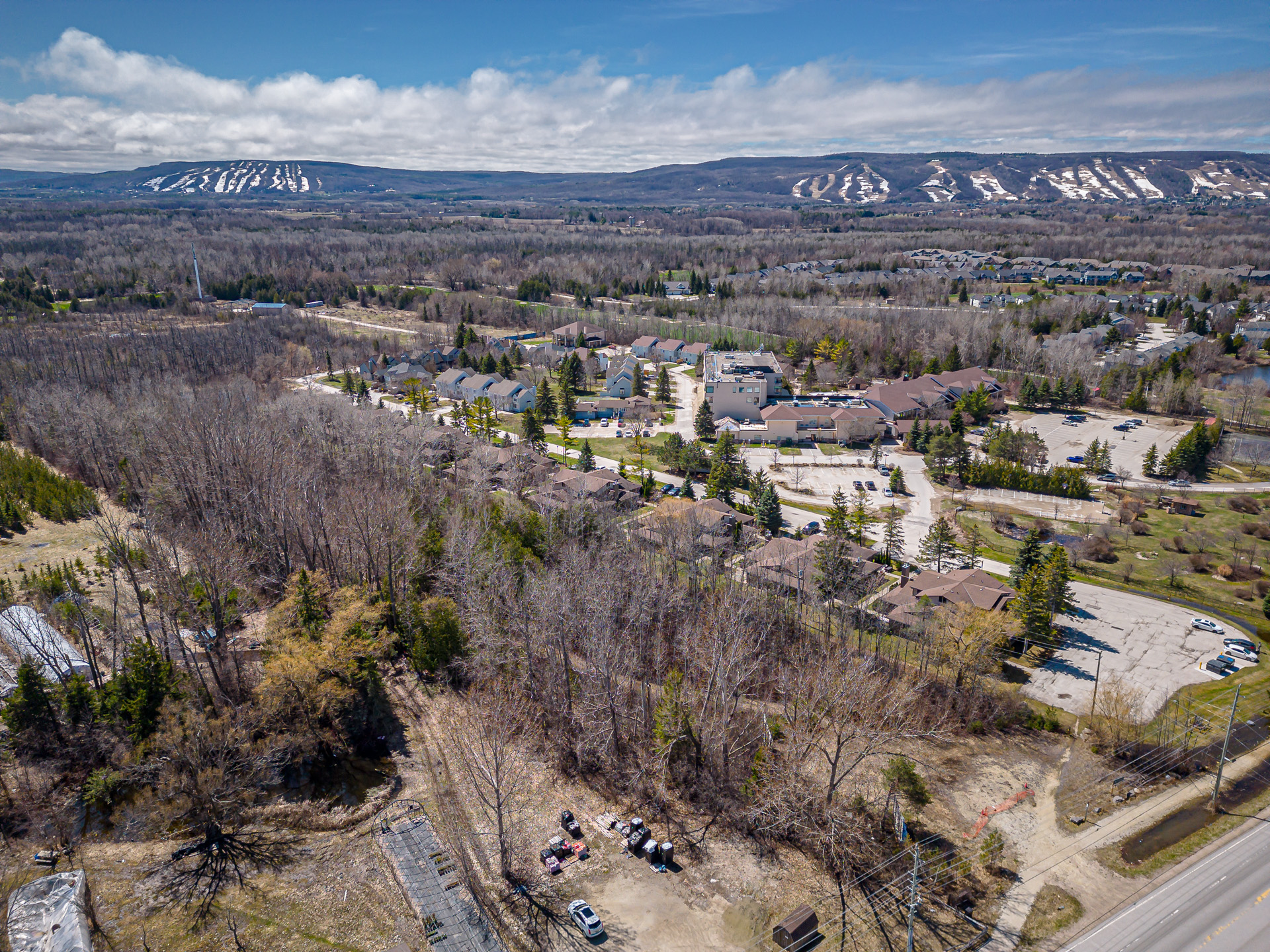
Escarpment Views
Sightlines toward Blue Mountain and the Niagara Escarpment.

04
Neighbourhood Setting
Located within an established residential pocket of the Cranberry community.

05
Residential Streetscape
Surrounded by mature homes, tree-lined streets, and quiet internal roads.

06
Community + Nature
A balance of built form and natural landscape throughout the surrounding area.
01 / 06
Cranberry Corridor
Positioned along Highway 26 with views stretching toward Georgian Bay.
01
Cranberry Corridor
Positioned along Highway 26 with views stretching toward Georgian Bay.
02
Bay Proximity
Just minutes from the shoreline, with easy access to waterfront trails and open space.
03
Escarpment Views
Sightlines toward Blue Mountain and the Niagara Escarpment.
04
Neighbourhood Setting
Located within an established residential pocket of the Cranberry community.
05
Residential Streetscape
Surrounded by mature homes, tree-lined streets, and quiet internal roads.
06
Community + Nature
A balance of built form and natural landscape throughout the surrounding area.
SITE & Development clarity

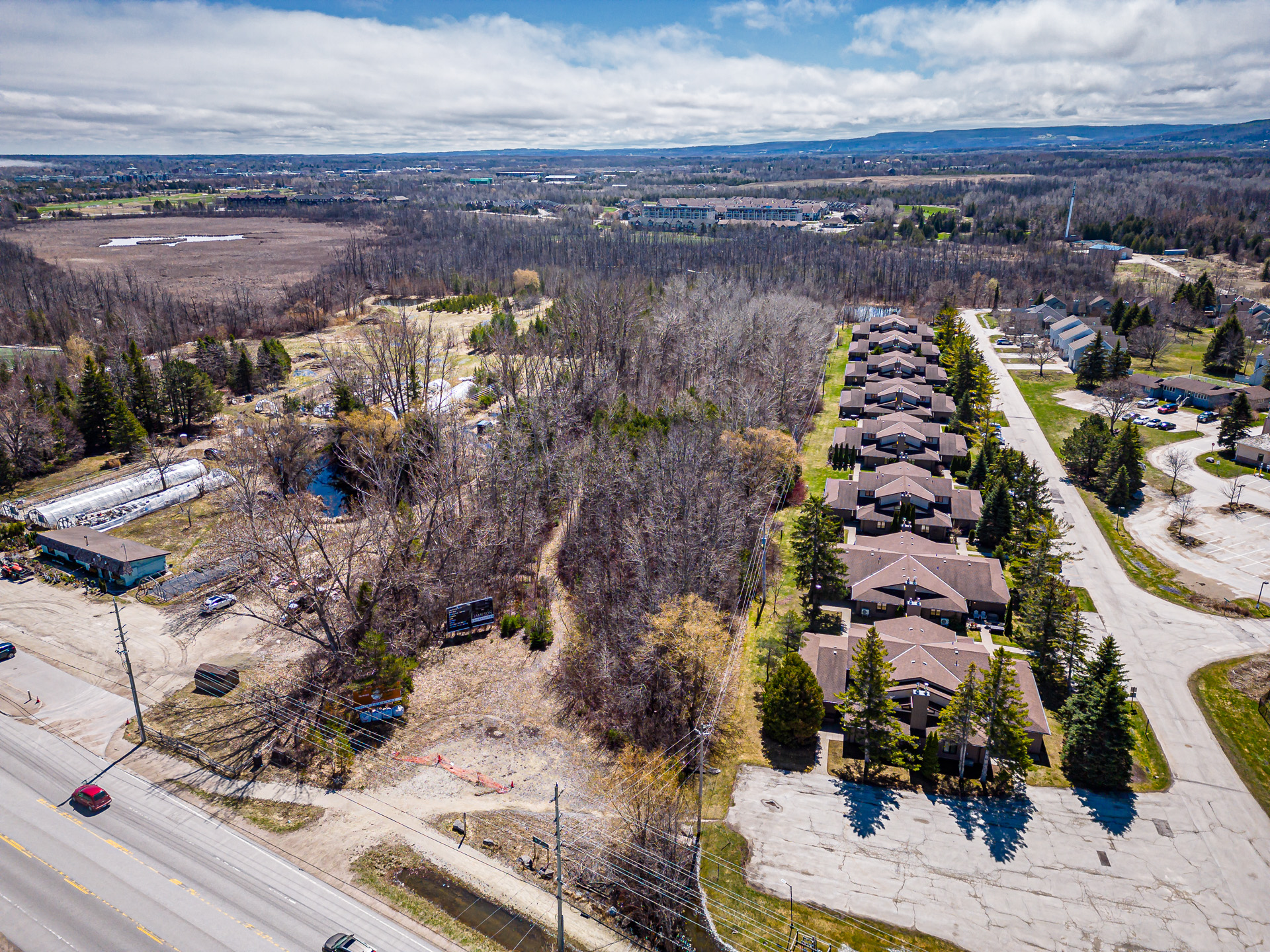
01
Site Perspective
Elevated view showing the development’s position within the broader landscape.

02
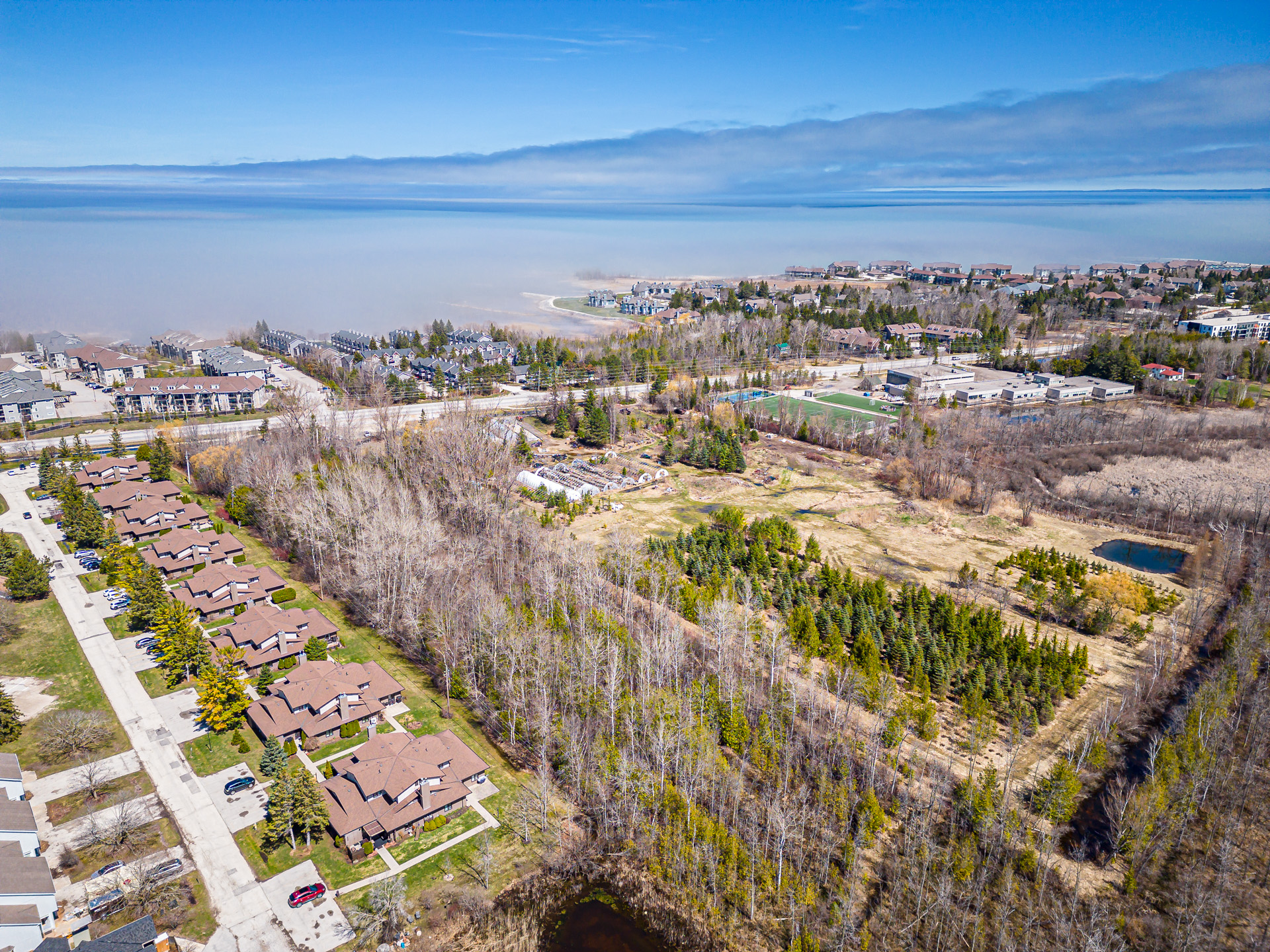
Neighbouring Interface
Illustrating how the site connects to adjacent homes and streets.

03
Surrounding Uses
A mix of residential, open space, and nearby amenities in close proximity.

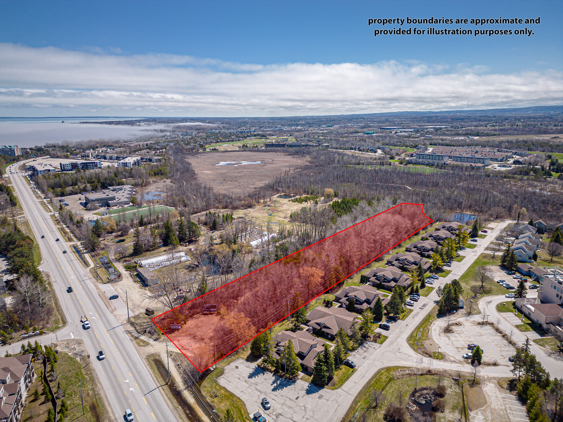
04
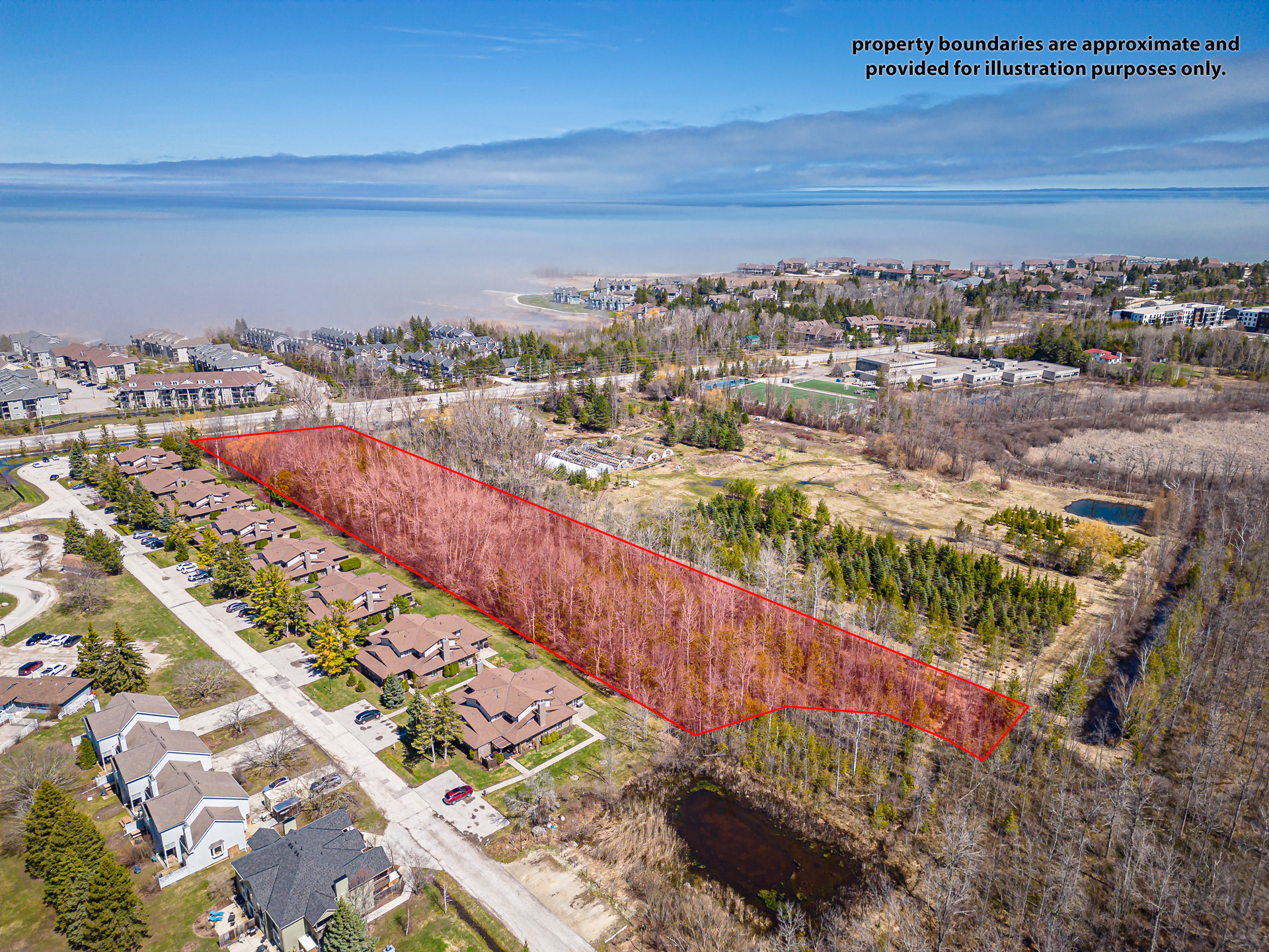
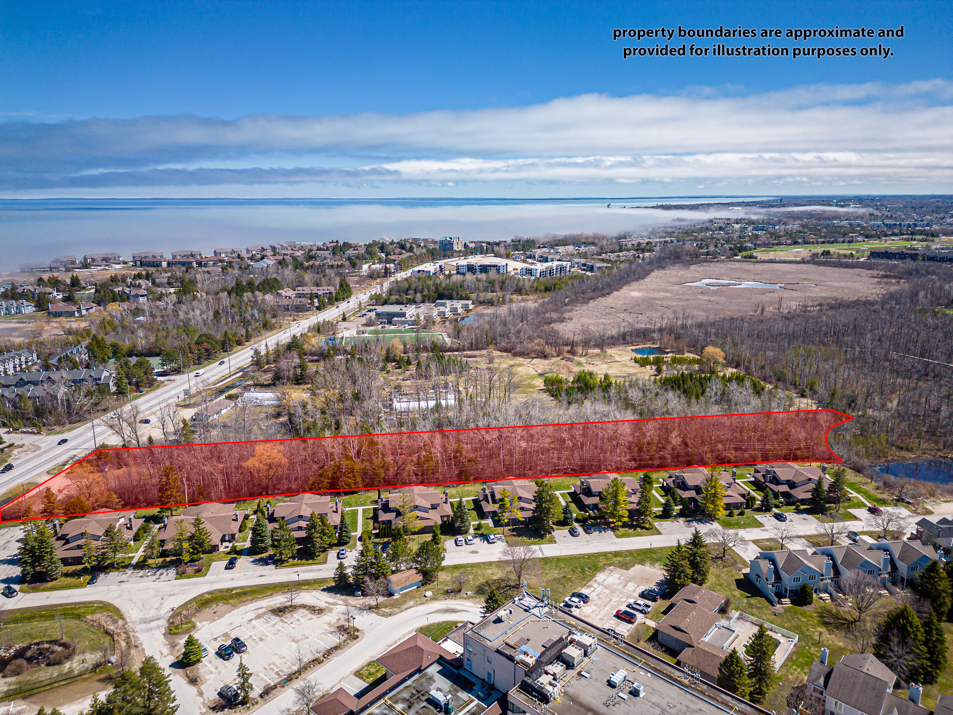
Development Footprint
Outlined site highlighting the full extent of the proposed lands.

05
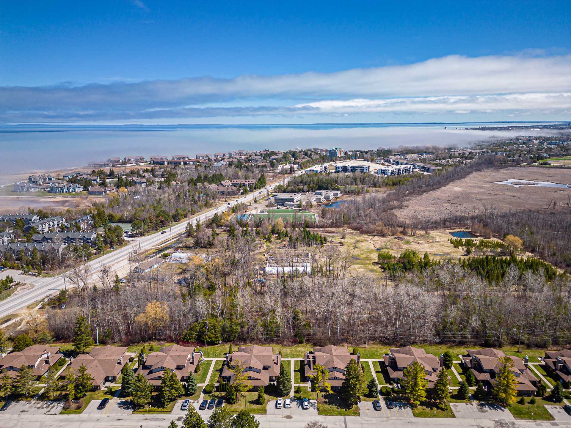
Site Depth + Scale
Demonstrating the length and scale of the property along Highway 26.

06
Frontage Exposure
Strong visibility and access along a primary Collingwood corridor.
01 / 06
Site Perspective
Elevated view showing the development’s position within the broader landscape.
01
Site Perspective
Elevated view showing the development’s position within the broader landscape.
02
Neighbouring Interface
Illustrating how the site connects to adjacent homes and streets.
03
Surrounding Uses
A mix of residential, open space, and nearby amenities in close proximity.
04
Development Footprint
Outlined site highlighting the full extent of the proposed lands.
05
Site Depth + Scale
Demonstrating the length and scale of the property along Highway 26.
06
Frontage Exposure
Strong visibility and access along a primary Collingwood corridor.
bottom of page